|
|
|
|
|
|
STATE
OF THE LAKE REPORT RELEASED
|
|
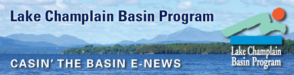
On
August 1st the Lake Champlain Basin Program released State of the Lake and
Ecosystems Indicators Report 2012. The report informs
citizens and resource managers about Lake Champlain's condition
and provides a better understanding of threats to its health and
opportunities to meet the challenges ahead.
|
|
The
latest edition of the document, which is produced every three or four
years and is based on the latest science and management perspectives,
summarizes several categories of lake health: phosphorus, human health,
fish and wildllife, and aquatic invasive species. This year's report
also includes a special section on the effects of the historic flooding
of 2011.
At the press event for the document's unveiling, LCBP Program Manager
Bill Howland noted, "Again, in 2012, we share both good and not so
good news, depending on which issue and which lake segment is being
discussed. Certainly the Lake is not meeting phosphorus concentration
targets, but each jurisdiction remains diligent and active in their
efforts to decrease loads."
The
LCBP has launched an online version of
the State of the
Lake, which includes all the content in the print document
as well as supplemental material and additional French translation.
Hard copies are also available free of charge by contacting kjarvis@lcbp.org.
|
|
|
|
|
LAKE CHAMPLAIN
COMMITTEE COMPLETES MISSISQUOI AIS SURVEY
|
|
|
|
|
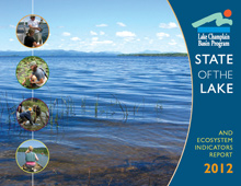
Project
scientist inventorying vegetation. Photo: Arrowwood Environmental.
|
Missisquoi Bay has
experienced several recent infestations by aquatic invasive species
(AIS), most notably water chestnut in 2005 and variable-leaf watermilfoil
in 2009. With LCBP funding, the Lake Champlain Committee and Arrowwood
Environmental partnered in 2011 to conduct an inventory of aquatic
invasive species and native aquatic vegetation and develop a plan to
address invasives in the Vermont portion of the bay.
The
inventory found three previously undocumented invasive species. Eurasian
watermilfoil is widespread but is largely interspersed with native
communities and is not choking out native vegetation, and European
frogbit was discovered in small numbers in three areas. Variable-leaved
watermilfoil has become well-established in one area, comprising up to
90% of the plant cover and choking out native water lily, eelgrass, and
water stargrass. The project documented a patchwork of eight different
natural communities. Three of these communities are not recognized in
their current form by the State of Vermont. In an effort to update and
standardize the state's aquatic community classification, two have been
proposed for adoption.
The
plan identified control of the Variable-leaved watermilfoil as a high
priority and recommended hand pulling. This particular population, which
has become well established and threatens State Significant native
communities, is one of only two in the state. Ensuring that European
frogbit does not become well-established also is a high priority. While
this species was found at low densities, eradication in the early stages
of establishment is vital.
|
|
SPINY WATERFLEA INVADES LAKE CHAMPLAIN BASIN
|
|
|
|
|
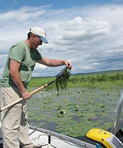
Spiny
waterflea fouls ropes and fishing lines. Photo: Minnesota Sea Grant
|
In
addition to the thousands of tourists and recreationists who visited Lake
Champlain this summer, one unwelcome visitor made its way to the Basin.
The invasive spiny water flea was first discovered in the Champlain and
Glens Falls Feeder Canals in June during routine work conducted as part
of the LCBP-supported Long Term Monitoring Project. By the end of July,
an angler also found the tiny zooplanton in Lake George, less than two
river miles away from Lake Champlain.
These
findings mark the first known occurrences in the Basin of the spiny water
flea, an aquatic invasive species native to Eurasia. Spiny water flea
feeds on other zooplankton that are prey for fish and other native
aquatic organisms, and foul anglers' fishing lines with their spiny
tails. They reproduce rapidly, particularly in warmer months, when they
can grow to maturity and lay more eggs in as little as two weeks.
"Resting" eggs can lay dormant in cooler waters for long
periods of time prior to hatching.
The
discovery served as a reminder of the critical need to address the
Champlain Canal's role as a potential vector of invasive species to Lake
Champlain. The Lake Champlain Basin Aquatic Invasive Species Rapid
Response Take Force recommended redirecting the flow of the feeder canal
into the Hudson River and moving forward with a long-delayed feasibility
study for a hydraulic barrier between the canal and Lake Champlain. The
Task Force recommended focusing immediate action on spread prevention,
emphasizing the need for public education, monitoring, and identification
of lake most susceptible to future invasions.
For
more information, please refer to the LCBP Spiny Water Flea
and the NYSDEC Lake George
news releases.
|
IJC ESTABLISHES FLOODING STUDY WORKGROUP
|
|
The
International Joint Commission (IJC) has appointed the International Lake
Champlain-Richelieu River Plan of Study Workgroup to examine and report
on the spring 2011 flooding in the Richelieu River and Lake Champlain and
its tributaries. The IJC established the workgroup in response to a
request by Canada and the United States for recommendations regarding a
comprehensive study of measures to mitigate flooding and its impacts in
the region.
The
IJC is an impartial bi-national body that assists the governments of
Canada and United States in resolving water resource issues along the
border. The ILCRR Workgroup consists of a co-chair, two members, and a
secretary from each nation.
|
|
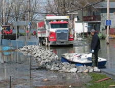
|
Flooded
streets like those of Venise-en-Québec were common along the Missisquoi
Bay shoreline during the spring 2011 floods. Photo: Québec MDDEP.
|
The
Workgroup will identify specific studies that are necessary to evaluate
the causes and impacts of the spring 2011 flooding and to develop
appropriate mitigation solutions and recommendations. The Workgroup will
consider gaps in data, policies, and communications. The plan will also
address adaptation to climate change and future water supply needs,
implementation of flood-plain management practices, and the need for
real-time flood inundation mapping.
With
input gathered at public meetings conducted in Québec and Vermont in
August, the Workgroup anticipates having a draft of the plan available
for review in October. After additional public meetings, the final plan
will be submitted to the Commission in December. Comments may be
submitted to the Workgroup website or
addressed to the Workgroup co-secretaries.
Stephanie Strouse
Madeleine Papineau
U.S Co-secretary
U.S.
Canada Co-secretary
Lake Champlain Basin
Program 801-1550
D'Estimauville Avenue
54 West Shore
Rd Québec,
Qc G1J 0C3
Grand Isle, VT
05458
Canada
USA madeleine.papineau@ec.gc.ca
sstrouse@lcbp.org
|
FLOOD CONFERENCE DRAWS MORE THAN 200
|
|
|

|
|
Vermont
DEC river scientist Staci Pomeroy (right) demonstrates the river flume
model to conference participants. Photo: LCBP
|
More than 200
scientists, resource managers, and policy makers gathered for two days in
Burlington, Vermont in June to examine flood resilience in the Lake
Champlain Basin. Organized by the Lake Champlain Basin Program, the
conference brought local partners and national experts together to
examine the impacts of last year's historic flooding from spring rains
and Tropical Storm Irene, and to consider steps to mitigate the
environmental and human impacts of future flood events.
Two
full days of presentations and forums resulted in lively discussions and
proposals. The program included sessions focused on technical aspects of
river and lake systems, emergency response, the impact of climate change
on future flood events, flood hazard mapping, and flood mitigation
policy. An evening session provided the public an opportunity to
participate in the dialogue and view a model demonstration of river
behavior and processes.
Several
common themes emerged during the program, including the importance of
allowing rivers to access their floodplains, the need for workable tools
and incentives to limit development in flood hazard areas, and the need
to communicate effectively with the public about water science and
management.
|
|
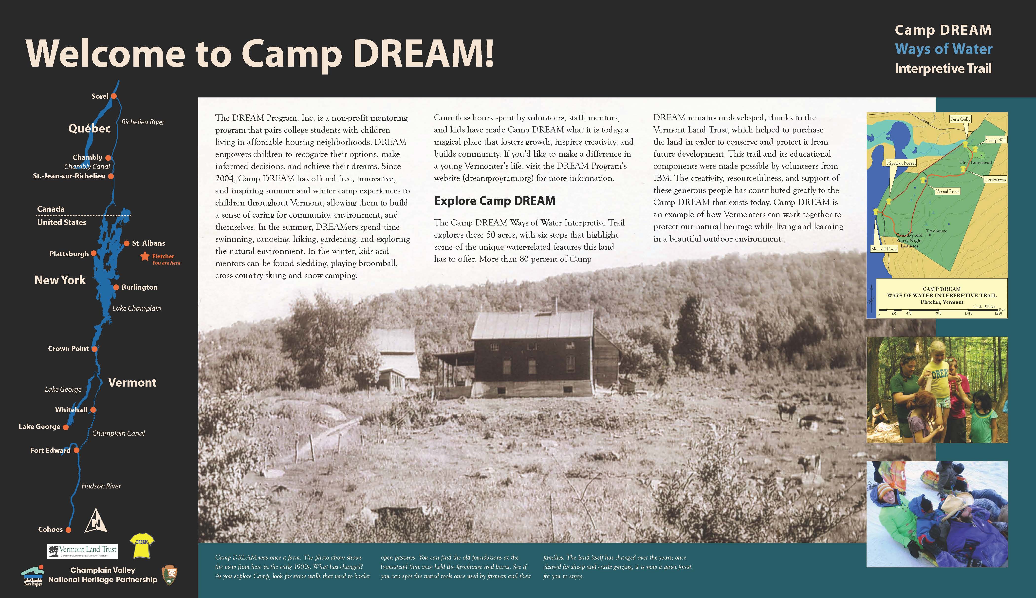
NEW EXHIBITS
INTERPRET WATER RESOURCES AT CAMP DREAM
|
|
The
Lake Champlain Basin Program (LCBP) and the Champlain Valley National
Heritage Area (CVNHP) provided interpretive planning and design services for
a non-profit summer camp for children living in low-income communities.
The Camp DREAM "Ways of Water Interpretive Trail" includes
seven wayside exhibits that focus on water quality on the 50-acre
property.
Located
on Metcalf Pond in Fletcher, Vermont, Camp DREAM offers free, innovative,
and inspiring summer and winter camp experiences to children throughout
Vermont, allowing them to build a sense of caring for the community,
environment, and themselves. The camp is a collaborative effort that includes
partnerships with many non-profit organizations, businesses, and
individuals. Volunteers from IBM developed the trail and collaborated
with LCBP/CVNHP and DREAM Program staff in crafting the interpretive
theme and the focus for each exhibit.
The DREAM Program, Inc. is a non-profit mentoring program
that pairs college students with children living in affordable housing
neighborhoods. Visit the DREAM program's website
for more information. Visitors are welcome to visit Camp DREAM when camps
are not in session.
|
|
|
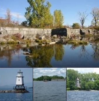
"Ways
of Water" Interpretive Trail exhibit
|
View
the Ways of Water Interpretive
Trail exhibits.
|
EDUCATORS EXPLORE THE LAKE CHAMPLAIN WATERSHED
|
|
|
|
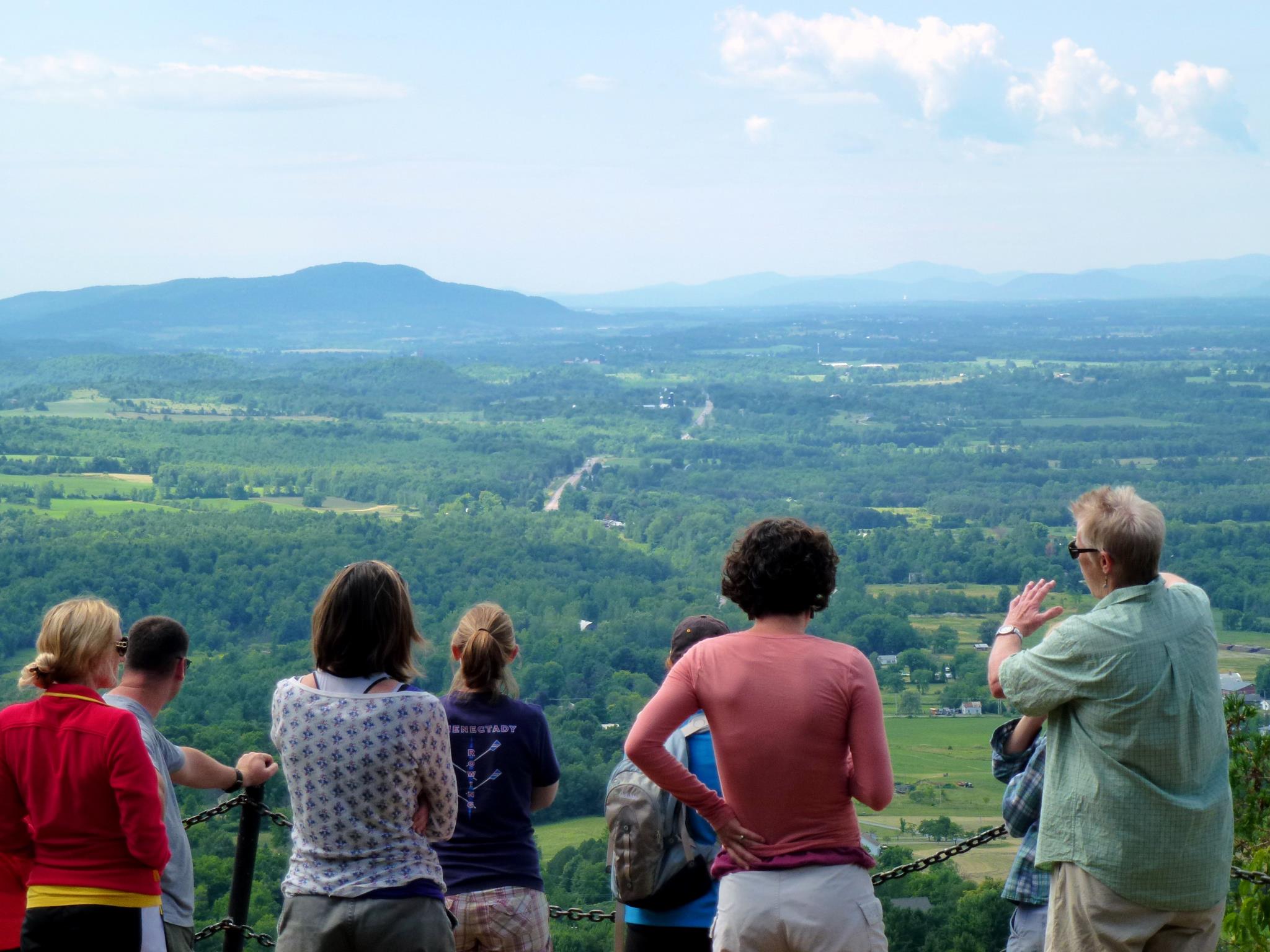
Char
Mehrtens, a professor of geology at UVM, teaches WEC teachers about the
geology of the Lake Champlain Basin from the summit of Mount Philo in
Charlotte, Vermont. Photo: LCBP
|
The
Champlain Basin Education Initiative (CBEI) partners worked with ten
middle and high school educators this summer during the first five days
of an eleven-day course, A
Watershed for Every Classroom. The educators, who have the
option of obtaining five graduate credits for the course through St.
Michaels's College, learned about the Basin's geologic history atop Mt.
Philo with University of Vermont's Dr. Char Mehrtens, and the history of
human settlement while rowing long boats with Maritime Museum staff.
While canoeing the LaPlatte River, they learned about the Lake Champlain
watershed, invasive species, the importance of journaling, and how
natural systems are linked together. They spent their last two days
exploring the Adirondacks, learning about the Boquet River communities'
experiences with Tropical Storm Irene, then monitoring the length of the
AuSable River from headwaters to its outlet into Lake Champlain.
Educators will meet again in October, February, and May to explore links
between agricultural, habitat, and water quality, how to integrate their
field studies with classroom technology, and how seasonal changes affect
the Lake Champlain Basin.
Current CBEI partners include: the LCBP, Shelburne Farms, Lake Champlain
Sea Grant - UVM Watershed Alliance, the Lake Champlain Committee and ECHO
at the Leahy Center. Amy Demarest from Our
Curriculum Matters works with the CBEI partners as the
curriculum coach. For more information on upcoming educator
programs, contact Colleen Hickey at the LCBP at chickey@lcbp.org.
|
|
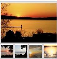
LCBP NOW on PINTEREST
|
|
|
|
|
Fabulous
Sunsets!
|
|
|
|
Favorite
Places
|
Check out our Boards on Pinterest.
Do you have a favorite place in the Basin
you would like to share? Send photos to info@lcbp.org.
Happy pinning!

|
|
CONTACT US!
|
|
 Main
Office in Grand Isle: Main
Office in Grand Isle:
(802) 372-3213 or
(800) 468-5227 (toll-free in NY & VT)
LCBP
Resource Room: The Resource Room at The Leahy
Center for Lake Champlain (top floor of ECHO Lake Aquarium & Science
Center) is open to the public seven days/week. Call (802)
864-1848 ext. 109 for more information.
|
|
|
|
|