Flood Resilience
The Lake Champlain Basin has a relatively wet climate, averaging 37.5 inches (95 cm) of precipitation throughout the year. On average, more precipitation falls in the summer and autumn than winter and spring months. High-intensity storms are not uncommon, particularly with the effects of climate change beginning to be felt in the Basin. These intense rain events can result in devastating flooding along river corridors and along the shoreline of Lake Champlain.
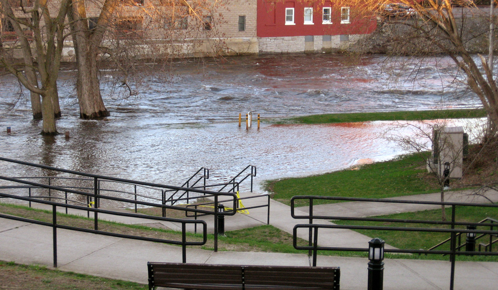
The topography of much of the Basin consists of steep mountains and narrow river valleys. With little flat ground in these valley bottoms for floodplains to absorb overflow from swollen rivers, flash floods threaten homes and transportation corridors located in valleys. Heavy spring rains coupled with mountain snowmelt can cause the water levels to rise on Lake Champlain. Any lake elevation higher than 100 feet above mean sea level on Lake Champlain is considered to be at flood stage. Lake floods inundate low-lying areas and threaten lakefront residential property and shoreline infrastructure.
Flooding is a natural process that has an important role in ecosystems and also can benefit human uses of the landscape. Flooding can replenish sediments and nutrients to floodplain soils, regenerating riparian vegetation and providing critical wildlife habitat, and also nourish soils that support agriculture along the Basin’s rivers. Flooding also can adjust streambeds and create new habitat for aquatic and riparian creatures by providing new wood material and other large debris to the streambed.
However, these benefits can become serious threats in areas that have been substantially altered by human activity. Excess sedimentation on river and lake bottoms can smother critical habitat for certain species. Sediments and nutrients are washed off unvegetated landscapes, impacting water quality and increasing the eutrophication rate (aging) of lakes and ponds. Healthy wetlands and vegetated shorelines can reduce the negative impacts from these events.
In recent years, floods have appeared to cause more significant destruction in the Lake Champlain Basin, in part because more homes and infrastructure have been built in flood-prone areas around Lake Champlain and its tributaries. Scientists are studying the effects of these recurring floods on the ecosystem, and are trying to determine whether floods are happening more frequently due to climate change, infringement of development on floodplains, or some combination of many factors. We cannot stop floods from occurring; therefore we must minimize the damage they cause by moving people and buildings out from flood-prone areas and restoring wetlands and shorelines so they can serve as a natural buffer between humans and the waterways we treasure.
Learn how one Vermont community restored a floodplain while creating a public park in this video from our Clean Water Commitment video series:
More on Flooding
Monitor Lake Champlain levels at these USGS gaging stations:
Burlington, VT | Whitehall, NY | Richelieu River at Rouses Point, NY
Get Lake Champlain Flood Information from the National Weather Service.