Determining the amount of sediment and nutrients captured by floodplains in the Lake Champlain Basin
Project summary:
Floodplains play an important role in storing and transforming nutrients in the Lake Champlain Basin, and floodplain restoration aims to revive and enhance these important functions where they may have been limited by river corridor alteration. The potential floodplain restoration benefits to nutrient load reduction have not been quantified in the Lake Champlain Basin, leaving a knowledge gap for managers seeking to restore floodplain function and reduce nutrient loads. Further, little is known about the factors that contribute to floodplain phosphorus deposition rates, making prioritization for restoration difficult.
Over two years in 2019 and 2020, partners at the University of Vermont developed a study to close these knowledge gaps. The three main goals of the study were to create an inventory of floodplains in the Vermont portion of the Lake Champlain Basin, document floodplain deposition of sediment and phosphorus, and develop a framework for predicting phosphorus deposition on floodplains in unmonitored areas. To achieve these goals, the project team
- created a map-based model to determine the locations of floodplains and their hydrologic connectivity;
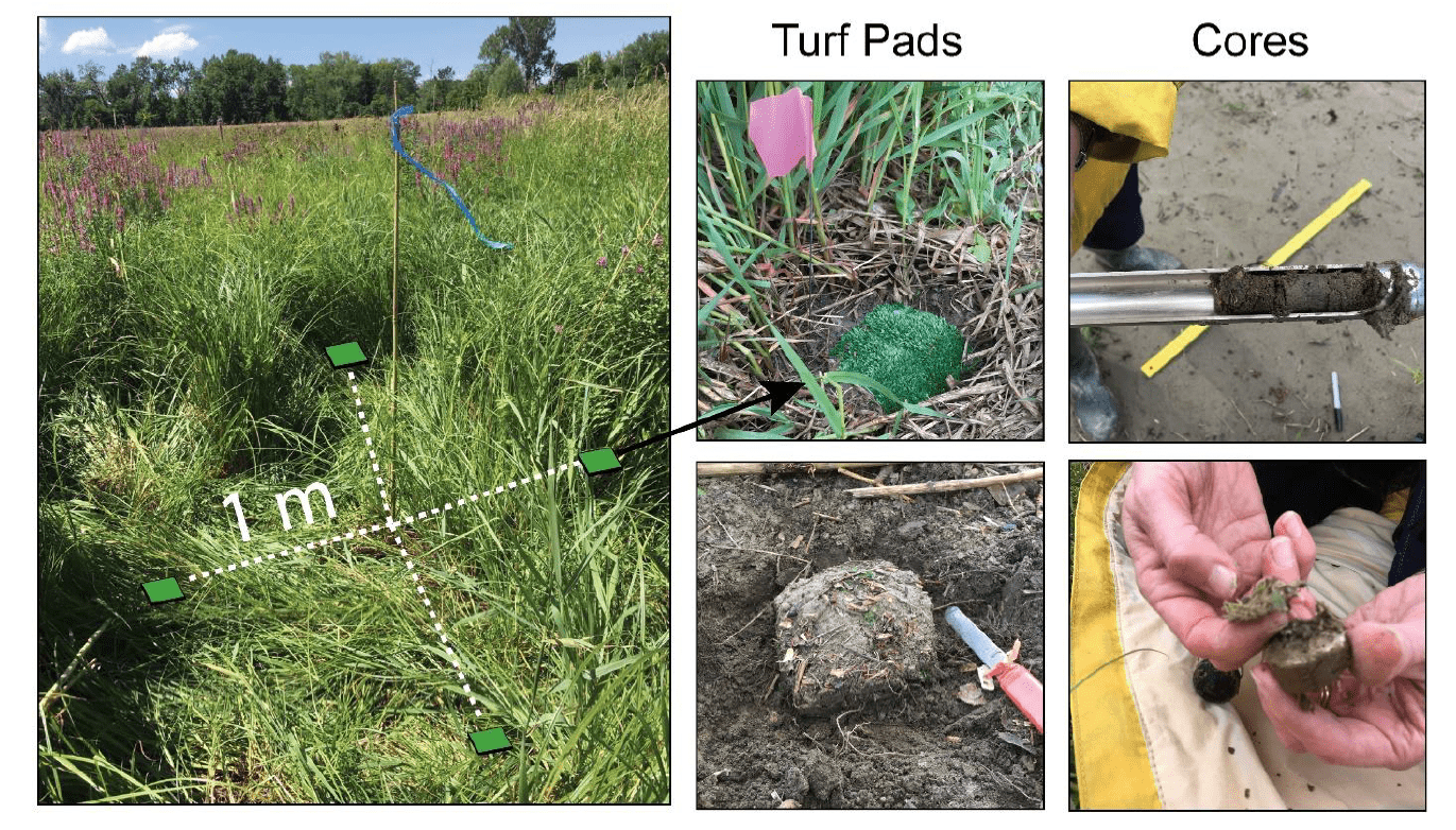
- used 170 turf mat plots at 24 floodplain sites to determine post-flood sediment and nutrient deposition rates (Figure 3); and
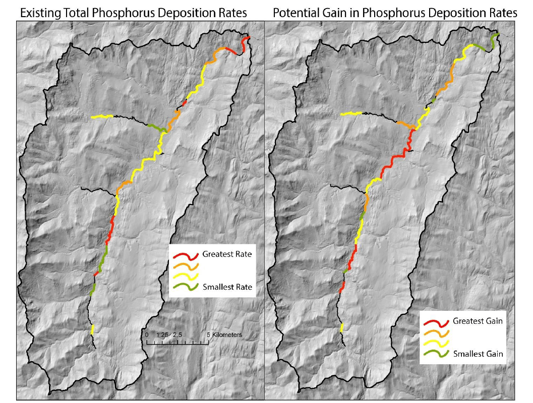
- developed an evidence- and map-based framework to prioritize floodplain management efforts (Figure 6).
Key results:
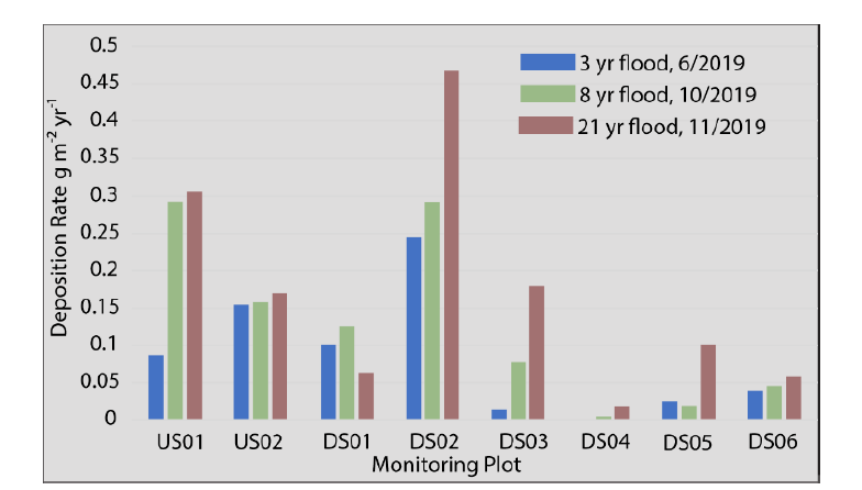
- During the study period, floodplains in the Lake Champlain Basin captured between 0.4 and 4.48 kg m-2 y-1 of sediment, corresponding to 0.02 to 3.3 g phosphorus m-2 yr-1 (e.g., Figure 9).
- Flood-derived sediment had an average total phosphorus concentration of 744 mg kg-1.
- The highest rates of phosphorus deposition were associated with very wide valleys, in watersheds with a relatively higher proportion of impervious surfaces, where channel incision was low, and the floodplain was classified as medium energy.
- At each sampling site, the mass of phosphorus deposition was greatest close to the channel (within 1 channel width), and where surfaces were regularly inundated.
- Maps of all floodplains are available for public download for planning and research at this link, with model methodology summarized in this manual.
Other takeaways:
- The data and models developed in this project have been incorporated into the Functioning Floodplains Initiative, and will continue to serve managers and researchers.
- The project team proposes to use the floodplain monitoring network established as part of this project to develop a long-term dataset of sediment and phosphorus deposition in the Lake Champlain Basin, potentially driven by volunteer community scientists.
The full LCBP technical report is available at this link and a PLOS ONE journal article related to this project is available at this link.