Wetlands

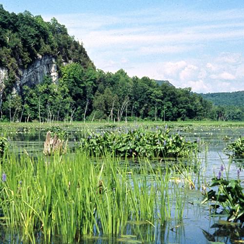
The Lake Champlain Basin has more than 300,000 acres of wetlands that are a vital part of the Basin’s ecosystem. Protecting wetlands, streams, and riparian habitats is important to the health of the Lake Champlain Basin for many reasons.
They…
- provide critical habitat and food for fish and wildlife
- filter sediments, pollutants and nutrients for clean water
- help control flooding
- protect groundwater and drinking water supplies
- stabilize shorelines
- prevent erosion
- maintain biodiversity
- provide recreation opportunities, such as birding, fishing and hunting
- provide educational opportunities to students young and old
Lake Champlain is part of the Atlantic Flyway, a migratory corridor for waterfowl and other wetland birds. As many as 40,000 ducks, geese and other migratory waterfowl depend on the Lake during their annual migrations to and from summer habitat.
Despite federal, state and local regulations protecting them, threats to wetlands persist. Wetlands still may be drained or filled for agricultural, residential or commercial purposes. The mapping, acquisition, and restoration of wetlands currently underway in the Basin are an important non-regulatory approach to wetlands protection and conservation.
Wetland Acquisition Strategy
This program works with willing landowners to permanently protect important wetlands. The LCBP supported the initial study to prioritize wetlands for acquisition, completed by The Nature Conservancy (TNC) in 1994, which has resulted in over $2.4 million in awards under the federal North American Wetlands Conservation Act (NAWCA). Over 88,000 acres of wetlands and surrounding areas in the Lake Champlain watershed have been acquired for protection under the program through 2012.
The Vermont Chapter of the Nature Conservancy is coordinating the project. Partners include the Adirondack and Eastern New York Chapters of the Nature Conservancy, Vermont Fish and Wildlife Department, and the New York Department of Environmental Conservation.
Wetland Restoration
As much as 50% of the Basin’s wetland areas have been lost to development and draining since colonial settlement of the region. In recent decades, substantial efforts have been made to restore historic wetlands, streams, and riparian areas to improve habitat and water quality in the Basin. As of 2011, nearly 4,000 acres of wetlands and 300 miles of riparian habitat have been restored by the US Fish and Wildlife Service’s Partners for Fish and Wildlife Program. This program is a partnership among the New York State Department of Environmental Conservation, Vermont Agency of Natural Resources, USDA Natural Resources Conservation Service, US Fish and Wildlife Service, and local organizations.
Other programs include the Natural Resources Conservation Service’s Wildlife Habitat Incentives Program and the Wetlands Reserve Program. In Vermont, the Wetlands Protection and Restoration Program, in cooperation with landowners, helps protect the water quality of Lake Champlain through the restoration and protection of wetlands. Since 2002, Québec has protected more than 1,693 acres of wetlands near Missisquoi Bay as part of the Pike River Ecological Reserve with the aid of The Nature Conservancy and other local organizations at a cost of about $1.2 million (CAD).
Wetland Mapping
The National Wetlands Inventory (NWI) maps for some areas of the Lake Champlain Basin are were last completed in the 1970s. Recent progress has been made on mapping wetlands in New York and Vermont, although there remain some areas of the Adirondacks in New York that still have not been mapped. The LCBP has funded updates of maps to NWI standards for wetlands outside of the Adirondack Park. Completing digitized maps within the Park remains a priority. In Vermont, maps have been updated using current remote sensing imagery and related technologies, assisted by field verification.
Learn how wetland restoration and protection helps to reduce phosphorus in Lake Champlain in this video from our Clean Water Commitment series:

