Phosphorus Sources
Targeted efforts over the last several decades have helped reduce the amount of phosphorus that comes from point sources such as wastewater treatment facilities and industrial discharges. Regulations in the 1970s that banned phosphorus from laundry detergents and infrastructure improvements since then have reduced the amount of phosphorus that comes from these point sources to only about 6% of the total phosphorus in the Lake.
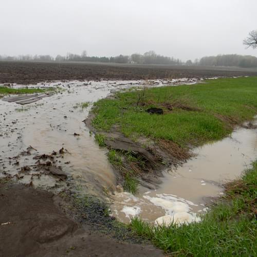
Nonpoint sources of pollution, which include runoff from roads and developed areas, and from lawns, farmlands, and other rural areas contribute more than 90% of the phosphorus that reaches the Lake. It is also likely that some phosphorus cycles up into the water from the sediments in the lake bottom, although we don’t yet know how much this in-lake cycling contributes to the overall amount of phosphorus in the lake.
Nonpoint Source Runoff
For every square mile of water on Lake Champlain, eighteen square miles of land in the Lake Champlain Basin deliver water to the Lake and contribute sediment, nutrients, and other potential pollutants. By comparison, the Great Lakes have only 1.5 to 3.4 times as much land as lake surface area. Most nutrients come from sources on the land, so the relatively high land-to-lake area ratio for Lake Champlain poses a significant challenge in limiting nutrient pollution.
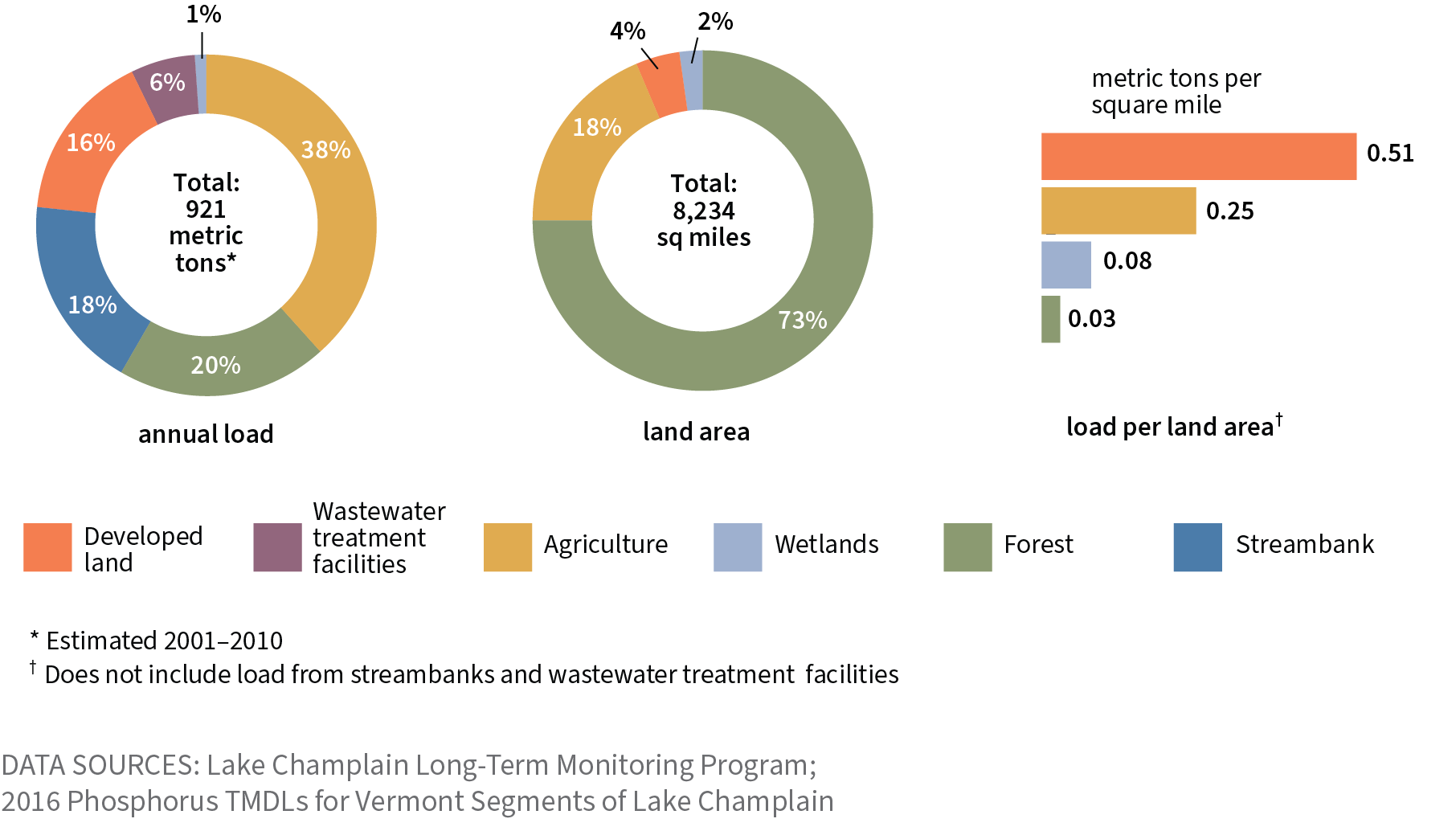
Rivers are the pathways for water, sediment, and nutrients to move into the Lake. Each year the Basin’s rivers deliver about 921 metric tons (2 million pounds) of phosphorus. Annual changes in load depend upon the amount of rain and runoff in the watershed. This variability due to precipitation and temperature may confound efforts to reduce phosphorus loading. While management practices may help to reduce inputs, the increasingly intense rainstorms associated with climate change may release more phosphorus, possibly cancelling out some gains made through pollution reduction efforts.
Long-term phosphorus loading trends have not improved in most Lake Champlain tributaries. While long-term decreases have been documented in the LaPlatte and Little Ausable Rivers, long-term increases in phosphorus loading have been documented in Lewis and Little Otter Creeks, and in the Poultney River. All other monitored tributaries show no significant long-term trends in phosphorus loading.
Phosphorus from Developed Land
Developed land can be a substantial source of nutrients and other pollutants to the Lake and can contribute substantially more phosphorus per land area than other land uses. Developed lands accounts for approximately 16% (147 metric tons or 323,600 pounds) of the total phosphorus load to Lake Champlain each year. Impervious surfaces, such as parking lots and rooftops, shed rainwater quickly and do not allow stormwater to soak into the ground. High storm flows increase erosion of streambanks, sending more sediment and nutrients downstream to the Lake.
Large surges of runoff from developed land can increase the severity of downstream flooding, causing property damage. Green infrastructure designs can reduce these high storm flows by slowing down and storing runoff, thereby reducing the amount of water and nutrients delivered to the Lake.
Phosphorus from Agricultural Land
Farming has long been a way of life for many in the Lake Champlain region, but agriculture can have a significant impact on water quality. Runoff and erosion from barnyards, laneways to pastures, and animal congregation areas can carry excessive pollution to nearby waterways and eventually to Lake Champlain.
Most conventional farms rely in part on commercial fertilizers and feed additives, and organic agricultural practices also can involve the application of fertilizer to increase crop productivity. Cattle farms and other animal-based operations generate large amounts of manure that must be disposed of or used carefully; farmers frequently spread manure on their fields to recycle nutrients back into crops and pastures. A portion of the nutrients within fertilizers, additives, and manure is washed off the land and into a waterway before it can soak into the ground.
Approximately 38% of the phosphorus load to the Lake comes from agriculture (352 metric tons or 775,000 pounds each year). One key challenge in addressing this long-term problem is that part of the load comes from legacy phosphorus—that is, phosphorus that has been added to soils over decades of farming. Such legacy phosphorus will continue to be released into the Basin’s waterways even as efforts to reduce future loading are underway.
Phosphorus from streambank sediments
The erosion of streambanks accounts for approximately 18% (165 metric tons or 365,000 pounds) of the annual phosphorus load to the Lake. Streambanks that lack significant woody plant growth can be susceptible to erosion during floods. Streambank erosion often occurs when lands near a river are altered to accommodate land use activity such as construction of a road, cultivation of farmlands, or any activity that removes or prevents a vegetated woody buffer. When streambanks erode and collapse into a stream, the change in flow patterns can cause increased erosion and the release of phosphorus in the future. Collapsed streambanks at the edge of agricultural fields may be especially high in legacy phosphorus.
Phosphorus from lake sediments
Stores of phosphorus are locked up in lake-bottom sediments as materials delivered from the watershed have settled to the bottom over many decades. Chemical reactions associated with low oxygen levels can cause this phosphorus to be released into the water. This phosphorus can fuel cyanobacteria growth in the shallow bays where sunlight penetrates closer to the bottom sediments. Hot, calm weather not only creates the conditions for this release of phosphorus, it is the type of weather that cyanobacteria prefer for growth.