Lake Champlain Basin History
The Lake Champlain Basin has a long and rich history. Many people think of this history as having begun with the arrival of Samuel de Champlain in 1609, but humans inhabited this landscape many centuries prior to his arrival. And the full story of the Basin began millions of years before the earliest humans walked the Earth.
2011
Champlain Valley National Heritage Partnership (CVNHP)
The management plan for the CVNHP is approved by the National Park Service. The CVNHP works with community partners to interpret and promote the region’s natural and cultural treasures in order to build appreciation and improve stewardship of these resources. Visit the CVNHP website →
(Image: LCBP)
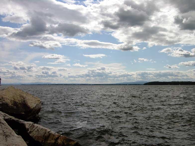
2002
Missisquoi Bay
In recognition of the deteriorating water quality of Missisquoi Bay, the governments of Vermont and Quebec establish a formal commitment to reduce their share of pollution entering the Bay. Vermont will have 60% of the responsibility for reducing phosphorus loads to the Bay, and Quebec will assume 40% of the responsibility.
(Image: LCBP)
2000
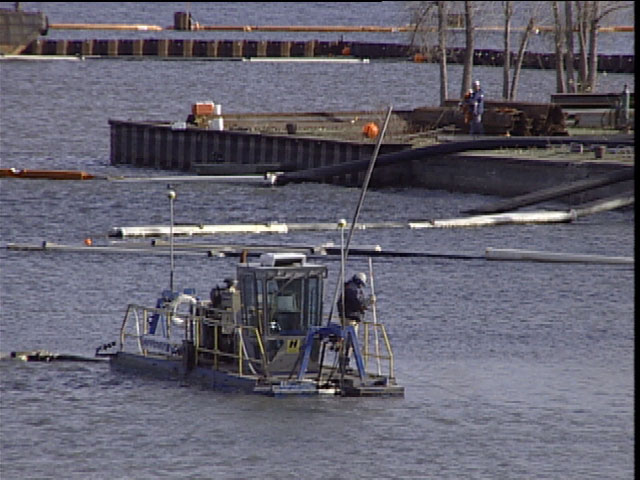
Cumberland Bay
A $35 million 50 acre cleanup of Cumberland Bay near Plattsburgh, NY which is led by the NYS Department of Environmental Conservation, removes 140,000 tons of PCB-contaminated paper sludge from the wood products industry. As a result, New York State revokes it’s special consumption advisory for fish for the Bay in 2011.
(Image: LCBP)
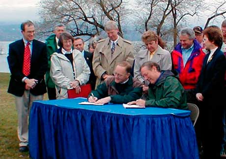
1996

Opportunities for Action
Opportunities for Action: An Evolving Plan for the Lake Champlain Basin (the Plan), the pollution prevention, control, and restoration plan that guides LCBP’s efforts, is first endorsed by the governors of New York and Vermont and the regional administrators of the USEPA. The plan is updated in 2003 and 2010.
(Image: LCBP)
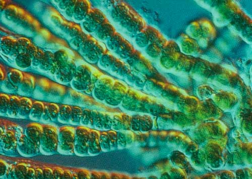
1993
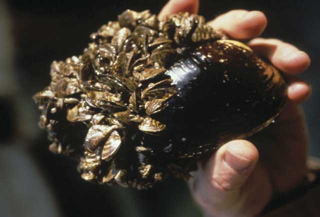
Zebra Mussels
Zebra mussels are found in Lake Champlain. The invasive mollusks spread throughout the Lake, affecting the ecosystem as well as underwater cultural artifacts.
(Image courtesy US Fish & Wildlife)
1991
Lake Champlain Basin Program
In June, the LCBP led by the Management Conference, begins working with committees, organizations, and government agencies to develop a future plan for Lake Champlain.
(Image: LCBP)
1990
Lake Champlain Special Designation Act
Lake Champlain is recognized as a resource of national importance and the Lake Champlain Management Conference (LCMC) is established. The LCBP is charged by Congress with creating a comprehensive plan for protecting and enhancing the Lake and its watershed area.
(Image courtesy US EPA)
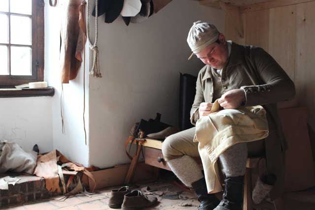
1974
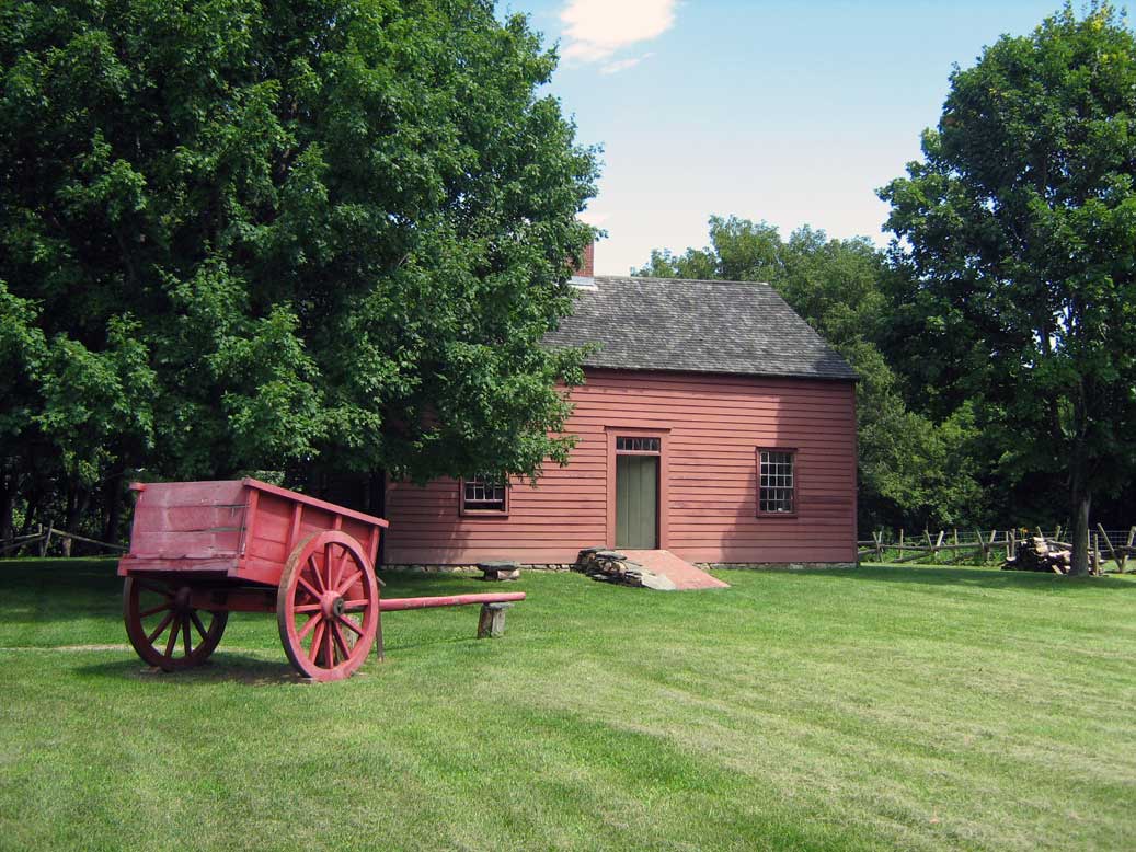
Ethan Allen Homestead
Vermont historian Ralph Nading Hill identifies a house on private land in Burlington’s Intervale as the home of Ethan Allen. Restored to the era, the Ethan Allen Homestead offers a living interpretation of life in the late 18th century on Lake Champlain.
(Image courtesy Mfwills CC-BY-SA-3.0)
1972
Clean Water Act
The Clean Water Act is signed into law by President Richard Nixon. The law establishes water quality standards and the basic structure for regulating the discharge of pollutants into the waters of the United States.
(Image courtesy Fir0002/Flagstaffotos)
1969

Proposed Nuclear Power Plant
A proposal to build a nuclear power plant on the shores of the Lake, in Charlotte, VT, is abandoned by the Vermont Yankee Nuclear Power Company. Opponents, led by the Lake Champlain Committee, feared warm discharge water from the plant would harm Lake ecology.
(Image courtesy: VT Digger)
1986
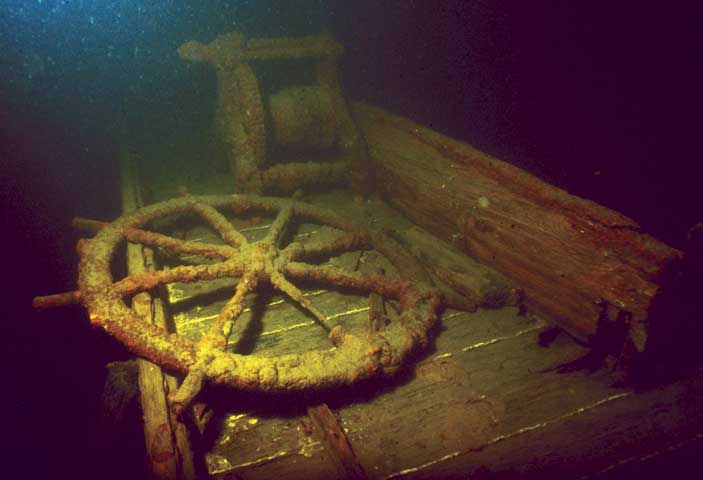
Lake Champlain Underwater Historic Preserve
As a route of trade and warfare for millennia, the bottom of Lake Champlain is home to numerous dugout canoes used by Native Americans, an intact revolutionary gunboat, and dozens of types of commercial vessels. Today, divers can safely explore nine shipwreck sites.
(Image courtesy Lake Champlain Maritime Museum)
1954
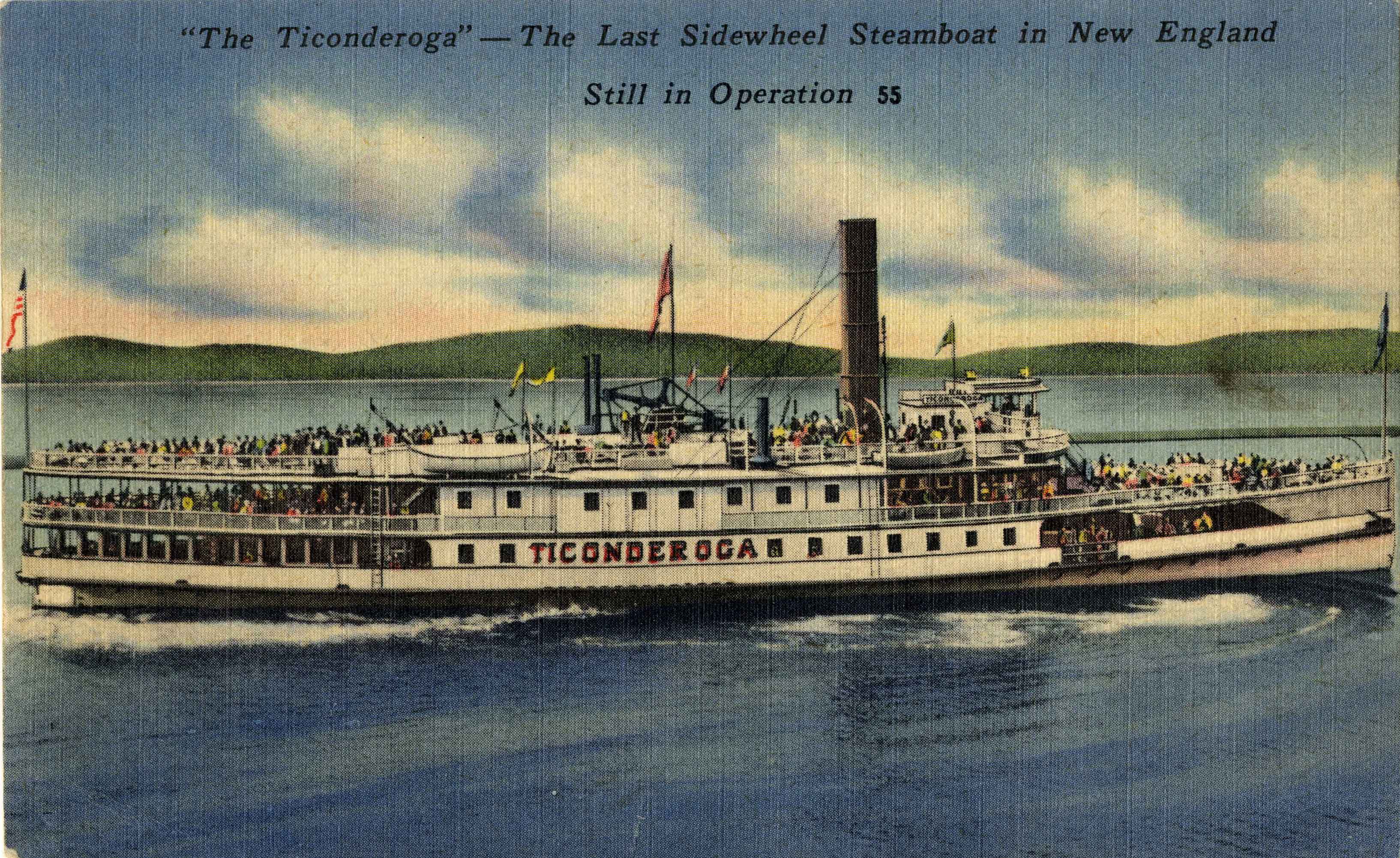
The Ticonderoga
The 222-foot, 892-ton Ticonderoga, built in Shelburne and the last steamship on Lake Champlain, is hauled two miles overland to the Shelburne Museum. Named a National Historic Landmark, the Ticonderoga has been restored to her 1923 appearance.
1932
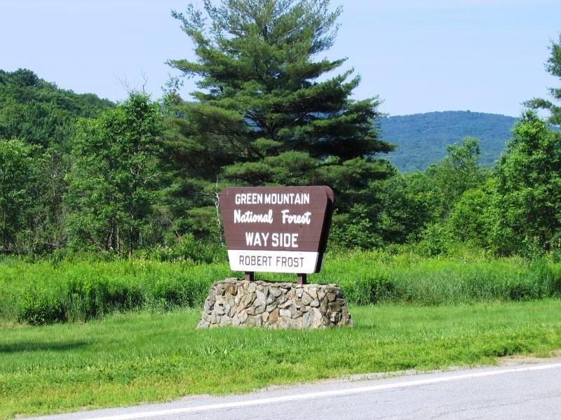
Green Mountain National Forest
The GMNF is established in response to the environmental degradation of unsustainable logging practices. Eleven years later the Missisquoi National Wildlife Refuge is established in Swanton, Vermont to protect lands that support a wide variety of wildlife species and habitats.
(Image courtesy visitusa.com)
1924

The Miner Family
In recognition of unique value to regional cultural heritage, the Alice T. Miner Colonial Collection opens to the public in Chazy, NY. The evolution of contemporary agricultural techniques is demonstrated at the William H. Miner Agricultural Research Center and the Kent-Delord House in Plattsburgh is restored.
(Image courtesy of the Alice T. Miner Museum)
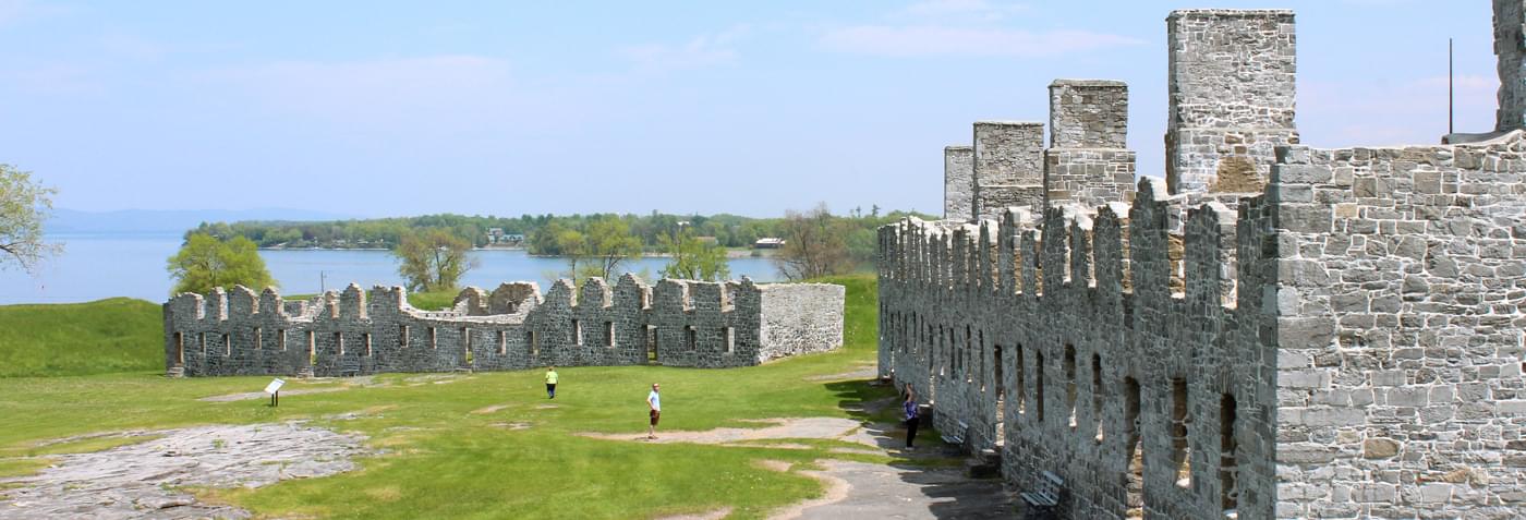
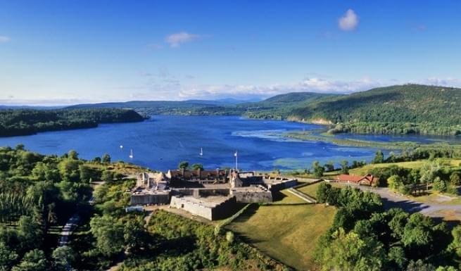
1910
Crown Point
New York State purchases the land around the ruins of Fort St. Frederic and Her Majesty’s Fort at Crown Point on the shores of Lake Champlain. The Champlain Memorial Lighthouse is dedicated two years later to commemorate the 300th anniversary of Champlain’s arrival.
(Image: LCBP)
1894

Adirondack Forest Preserve
The Adirondack Park receives protection under the NYS constitution, making it “forever wild.” The Adirondack Forest Preserve became a National Historic Landmark in 1963.
(Image courtesy Anne Bailey)
1873
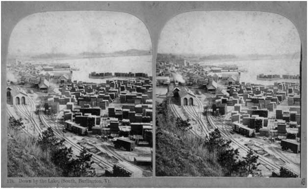
Lumber Industry
More than 170 million board feet of lumber are processed in Burlington. With thousands of boat dockings, the city is the third largest lumber port in the nation—behind only Chicago and Albany. Most of the old-growth forests had been cleared a few generations earlier, so most of the timber comes from Québec.
(Image courtesy of UVM Landscape Change Program)
1849
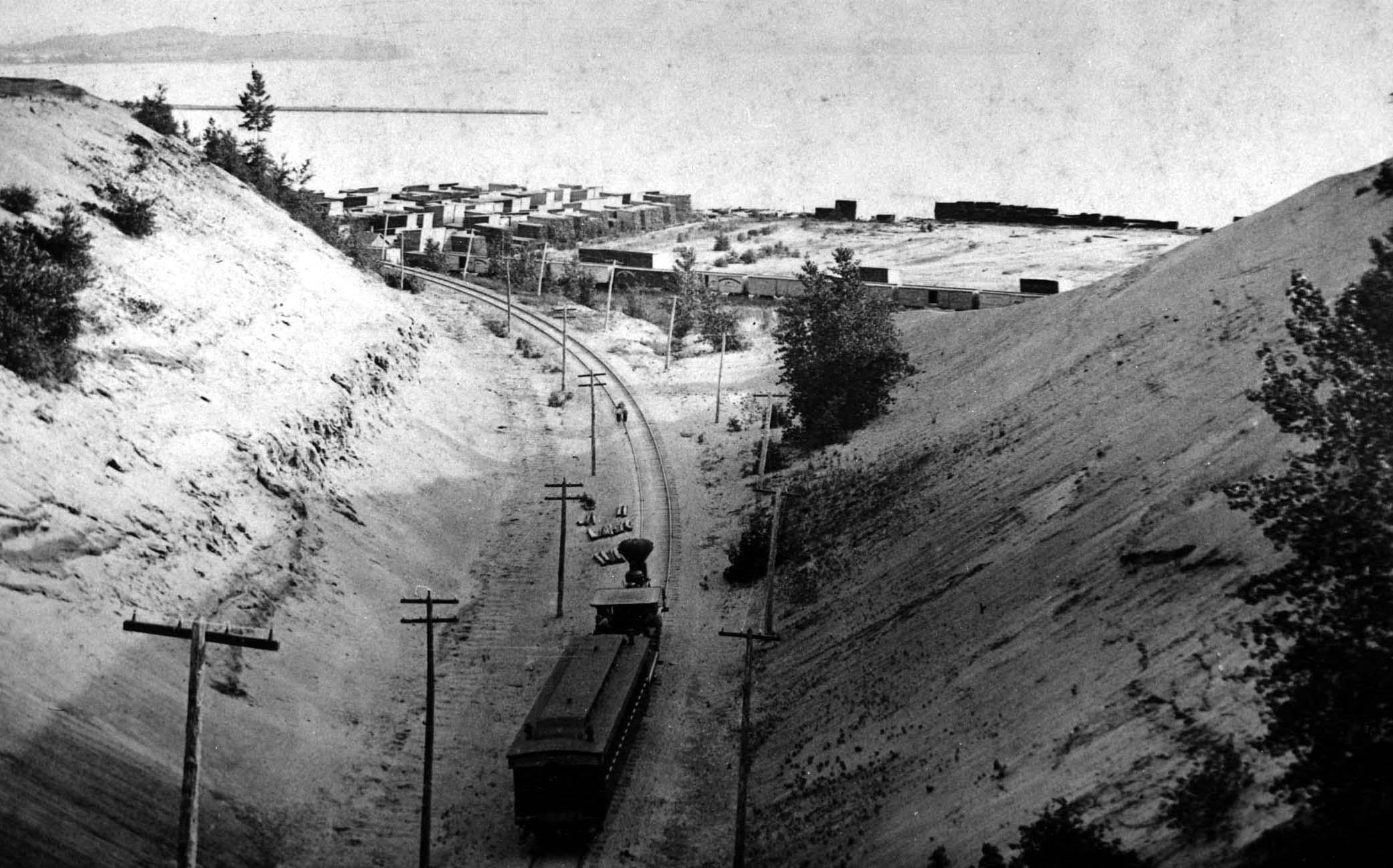
Railroad
A railroad connects Burlington to Boston, linking the Champlain Valley with the eastern seaboard, signaling the end of commercial water travel in the region. Once a railroad was constructed along the shores of Lake Champlain in 1875 iron ore and other bulky cargos no longer ship by boat.
(Image courtesy UVM Special Collections, Bailey Howe Library)
1823
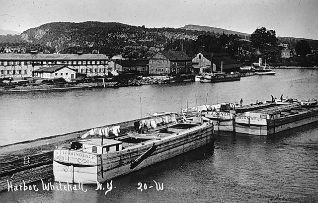
Champlain Canal
The Gleaner of St. Albans, a sailing canal boat, becomes the first vessel to pass through the Champlain Canal. Built as a prototype for the much longer Erie Canal, the Champlain Canal, which connects the Lake with the Hudson River, changed the Champlain Valley forever.
(Image courtesy Kevin Crisman)
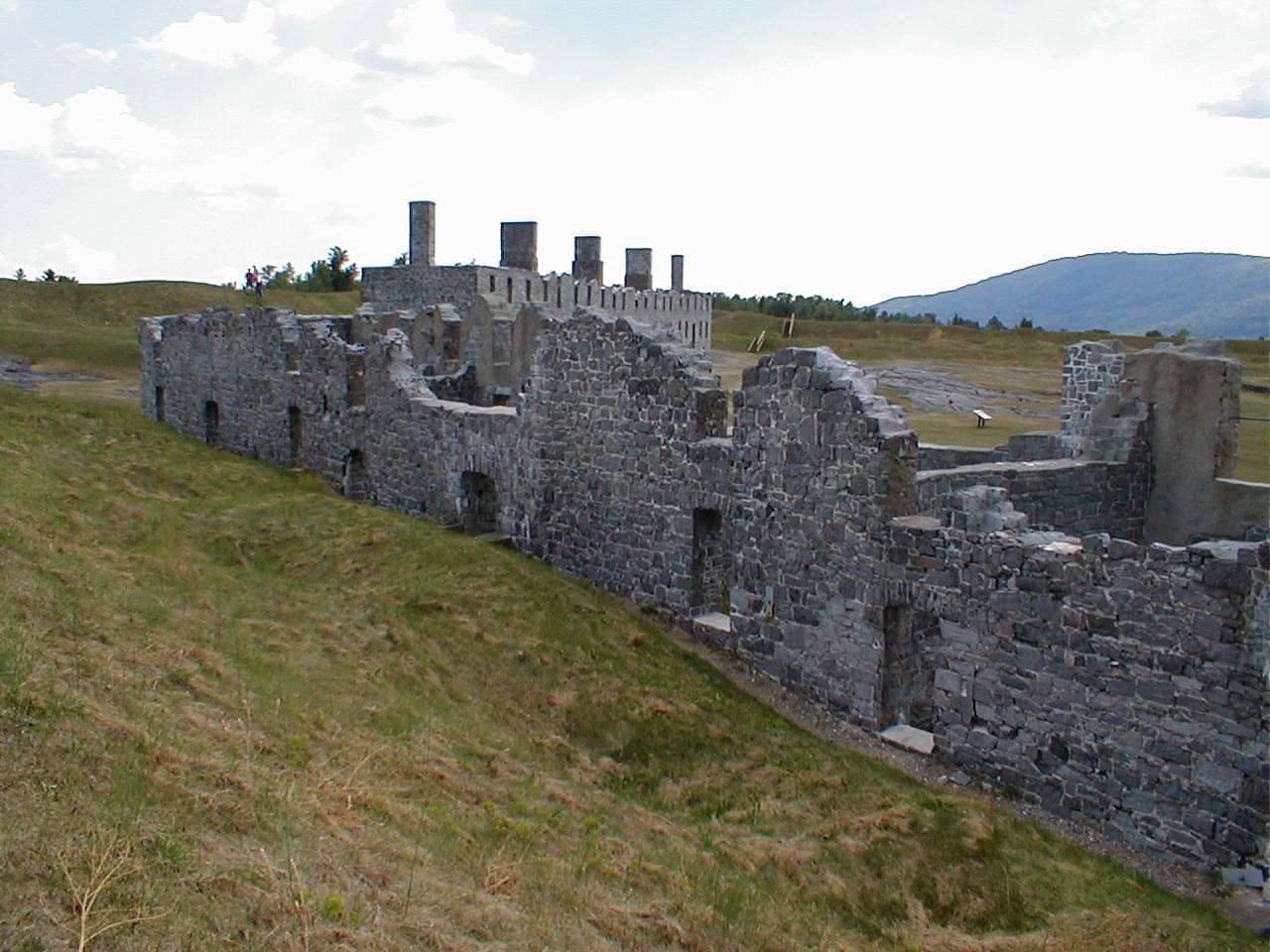
1820
Fort Ticonderoga
William Ferris Pell purchases the fort’s ruins to prevent neighbors from taking its stones. Decades later, his grandson, Stephen Pell, and his wife, Sarah Thompson Pell, restore the fort. President Taft attended the opening of the refurbished fort in 1909 for the 300th anniversary of Champlain’s arrival to the Lake.
(Image courtesy Lake Champlain Region)
1815
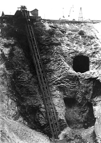
Iron Ore Mining
New York State’s mining industry achieved its greatest extent in the 19th century. The eastern Adirondacks were a center of iron ore mining During the Civil War, iron from the Adirondacks constituted 25 percent of the nation’s production and was critical to the war effort.
(Image courtesy www.miningartifacts.org)
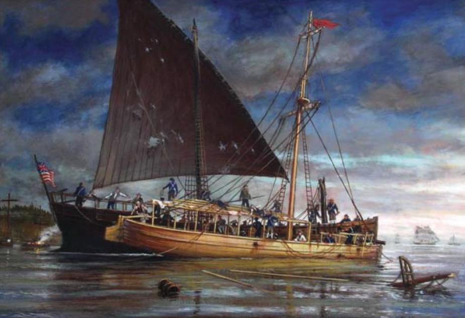
1814
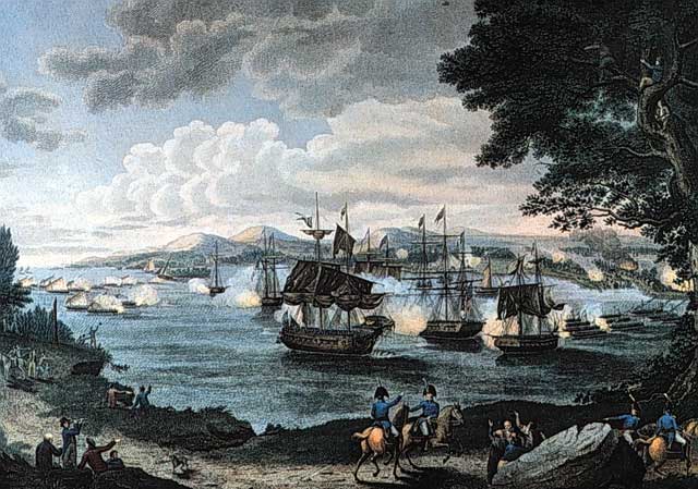
British Invasion of Plattsburgh
On September 11, a flotilla of Royal Navy ships commanded by Captain George Downie rounds Cumberland Head to face a squadron commanded by Master Commandant Thomas Macdonough. Though outgunned and less experienced, the Americans win the 6-hour battle.
(Image from Wikipedia – Engraving B. Tanner)
1809
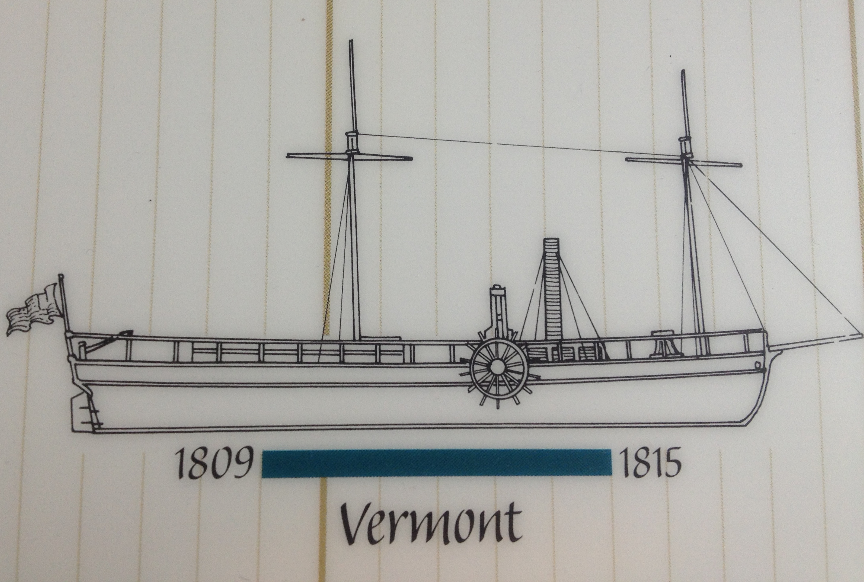
Steamboat Vermont
The first steamer on Lake Champlain launches in Burlington, two years after the world’s second commercial steamer. The vessel survived the War of 1812, but it sank in the Richelieu River in 1815 when its crankshaft disconnected and punched a hole through the hull. Steamer passenger services that followed operate successfully for several decades.
(Image courtesy Kevin Crisman)
1776
American Revolution
On October 11, America’s first naval fleet battles a superior British fleet near Valcour Island. General Benedict Arnold’s fleet is roundly defeated but delays the British advance down the Lake. In 1777 a better prepared American army defeats the British at Saratoga.
(Image courtesy Lake Champlain Maritime Museum. “Sinking of the Philadelphia” by Ernest Haas)
1609
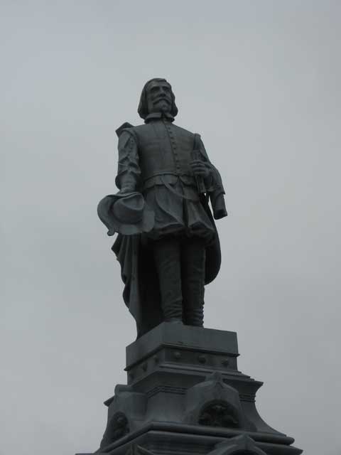
Arrival of Champlain to the Lake
In July, Samuel de Champlain explores the Lake. Champlain traveled up the Richelieu River with his native allies to drive the Iroquois from the Lake. The French explorer gave us the first written account of the region; the first map; and he named the Lake for himself.
(Image: LCBP)
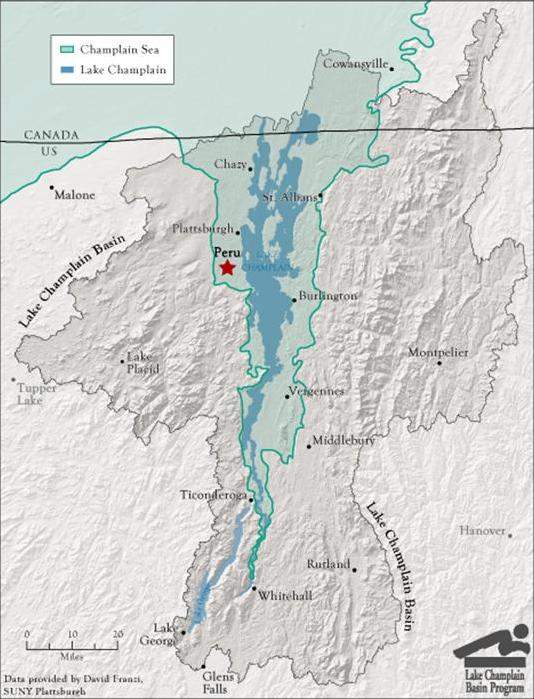
9,000 Years Ago
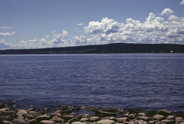
Lake Champlain
With the weight of the glaciers removed, the earth’s crust rebounds, floating on the mantle below. The Basin is isolated and the supply of sea water is cut off. The Champlain Sea gradually returns to fresh water and the present day Lake Champlain.
(Image: LCBP)
11,000 Years Ago
The First People
After the glaciers retreated, rich nutrients of the pioneering plants attracted herds of elk, caribou, and mastodon. The first native peoples followed these large mammals into the region.
(Image courtesy Fred Wiseman)
13,000 – 9,000 Years Ago

Champlain Sea
The glaciers melt and retreat further northward, allowing saltwater from the Atlantic Ocean to enter the Champlain and St Lawrence valleys.
(Image courtesy Greg Hume)
15,000 – 13,000 years ago
Lake Vermont
The climate warms and the glaciers retreat, creating a large freshwater lake which flows south to the Hudson River.
(Image: LCBP)
3 MYA
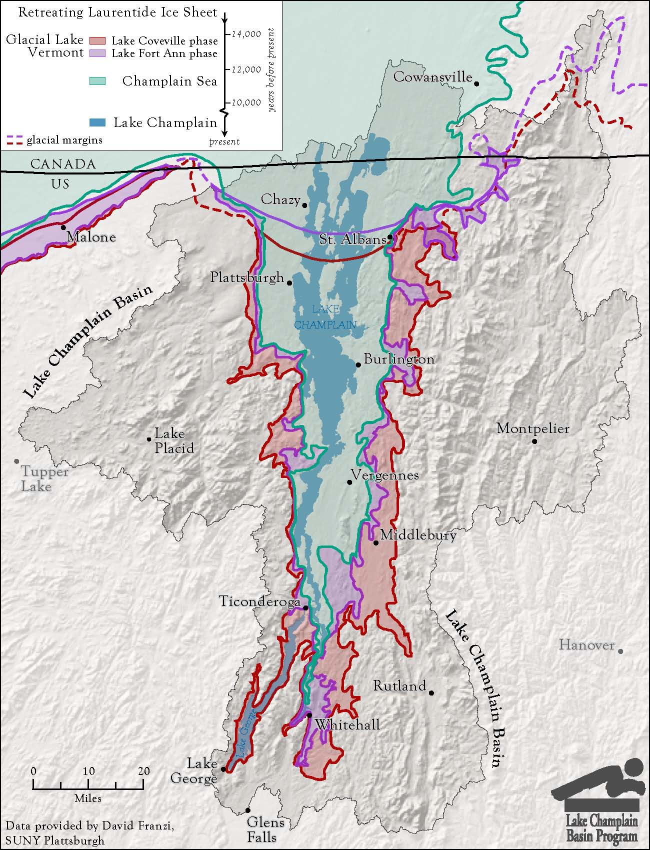
Ice Age
The climate cools and glaciers begin to form in northern regions. The glaciers advance and retreat across the landscape, reshaping the Basin.
(Image: LCBP)
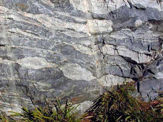
165 – 85 MYA
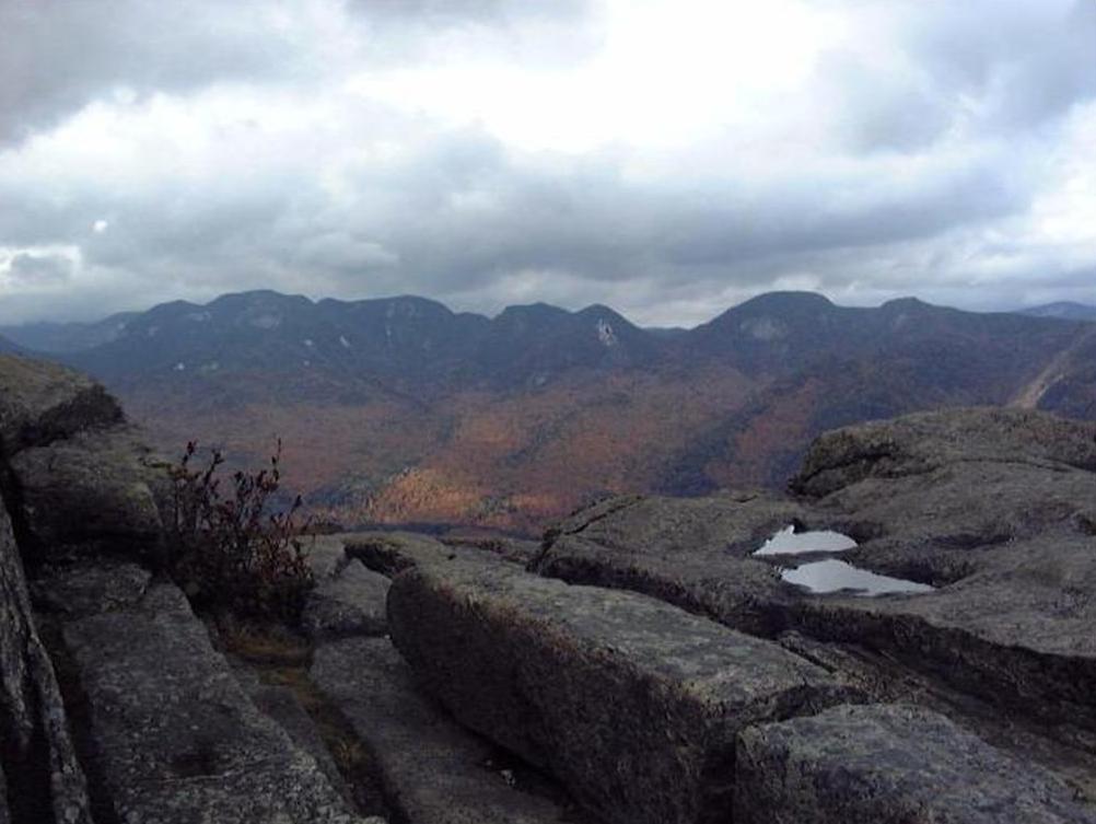
Modern Adirondacks
Today’s Adirondack dome rises from the ancient roots of the ancestral mountains.
(Image courtesy Glenn A. Richard, Stony Brook University)
450 – 370 MYA
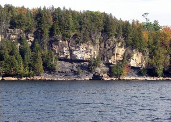
Green Mountains
Continental collisions create the Green and Taconic mountains. The ancient Iapetus Ocean closed as continental plates came together. The sedimentary rocks of the shoreline and continental shelf were folded and faulted to form the Green Mountains.
(Image courtesy C. McCormack, Vermont Geological Survey)
600 – 370 MYA
Iapetus Ocean
The continental plates pull apart and a tropical equatorial sea covers much of what is now the bedrock of the Champlain Valley.
(Image courtesy Glenn A. Richard, Stony Brook University)
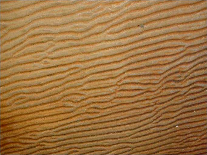
1.3 – 1 BYA
Grenville Mountains
The earth’s shifting tectonic plates push up the precursors of the Adirondack Mountains, which gradually erode away.
(Image courtesy Glenn A. Richard, Stony Brook University)