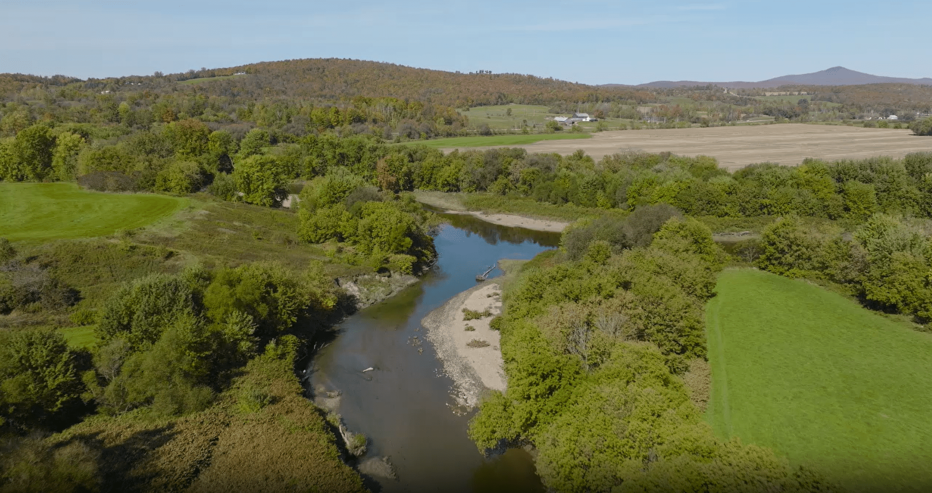
The Confluence of the Trout and Missisquoi Rivers
The binational Missisquoi River originates in rural northern Vermont and runs through Québec for a stretch before reentering Vermont and draining into Lake Champlain’s Missisquoi Bay.
The main stem runs for 80 miles and is fed by tributaries from the north and south. One tributary, the Trout River, forms a confluence with the Missisquoi at East Berkshire, a small town nestled in Vermont’s Northeast Kingdom. The Trout River confluence is this month’s Place in the Basin.
A confluence occurs where two rivers meet and merge to become one larger river. In the case shown here, the Trout River ends and becomes the Missisquoi River. Confluences are important nodes in a river system that affect the dynamics of water moving through the river system, sediment transport, water chemistry, and river biology. River confluences are locations of interest to researchers and resource managers concerned with the biological process and ecosystem services unfolding at these points of juncture.
In 2014, sections of the Missisquoi and Trout Rivers were granted the Wild and Scenic River Designation for their significant cultural, scenic, recreational, and water resource values. Established in 1968, the Wild and Scenic Rivers Act set out to protect selected rivers in their free-flowing condition to preserve their water quality and meet other conservation goals.
The Missisquoi River provides ample opportunities for paddling, birding, and angling. Cold, high-elevation streams and slow, warm stretches make for a diverse fishery. The river also provides drinking water to adjacent communities and serves agricultural needs in the region.
The Missisquoi and Trout River watersheds are home to unique geology and rich history. Serpentine Outcrops, a rare geological phenomenon in our region, can be found along the Missisquoi in the Vermont towns of Lowell, Troy, and Westfield, and attract geologists from around the world. The two rivers feature the highest density of covered bridges anywhere in the country, all built in the 1800’s and six of which are still in use today.
Many restoration projects are underway along the Missisquoi and throughout its watershed to increase flood resiliency, reduce nutrient loading, manage invasive species, and improve water quality Missisquoi Bay. A shallow bay with a broad and largely agricultural drainage area, Missisquoi Bay sees frequent cyanobacteria blooms throughout the summer months and is a target area for phosphorus reduction efforts in both the United States and Canada.
The Missisquoi River Basin Association led the charge on securing Wild and Scenic designation, a process that required years of gathering community support. Now, several organizations are working to improve river access for paddlers, anglers, and recreationists of all kinds.
At the Granby Zoo in Québec, the annual Mikinak Festival provides an opportunity for community members to release spiny softshell turtles into the water. Visitors connect with this endangered species and learn about efforts to protect populations in the Lake Champlain basin.
Every summer, Northern Forest Canoe Trail mobilizes seasonal staff and volunteers on projects that improve river access. From upgrading informal access points to establishing new ones, the projects undertaken by community members each season have been increasing the accessibility of recreation on the Missisquoi River.
To get involved, check out the following organizations working to protect and restore the Missisquoi River and Missisquoi Bay:
Missisquoi River Basin Association
Organisme de bassin versant de la baie Missisquoi
Upper Missisquoi and Trout Rivers (UMATR) Wild & Scenic Committee
Friends of Northern Lake Champlain
Northwest Regional Planning Commission
Franklin County Natural Resources Conservation District
Orleans County Conservation District
Northern Forest Canoe Trail
Franklin Watershed Committee
Abenaki Nation of Missisquoi