Mount Mansfield as Seen from South Hero
At 4,395 feet, Mount Mansfield is the highest mountain in the state of Vermont. Viewing the distant mountain from the shore of Lake Champlain is equally as breathtaking as taking in the long Lake from Mansfield’s summit.
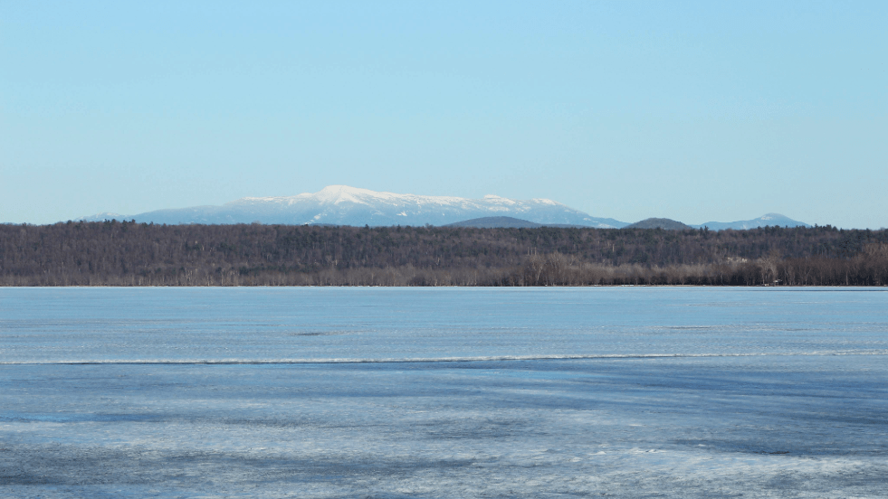
This month’s Place in the Basin takes us to a location familiar to many who spend time in the Champlain Islands. The southern gateway to the Islands, US Route 2 runs across a causeway bridging Milton and South Hero, Vermont. On the eastern end of the causeway is Sandbar State Park, a popular summer destination for swimming and picnicking.
At the western end of the causeway on the north-facing side is a small bay home to the Apple Island Marina and the John Guilmette fishing access area. One a clear day, one can stand on the boat ramp and see the western face of Mansfield standing in the distance. This location is where the photo above was taken and is this month’s Place in the Basin.
The causeway running between Milton and South Hero divides the Northeast Arm of Lake Champlain (sometimes referred to as the Inland Sea) from Mallets Bay. Located entirely within the state of Vermont, the Northeast Arm holds about 13% of the Lake’s volume. This relatively deep region of the Lake is dotted with islands, bays, and shallower areas, creating a favorite area for many boaters and anglers.
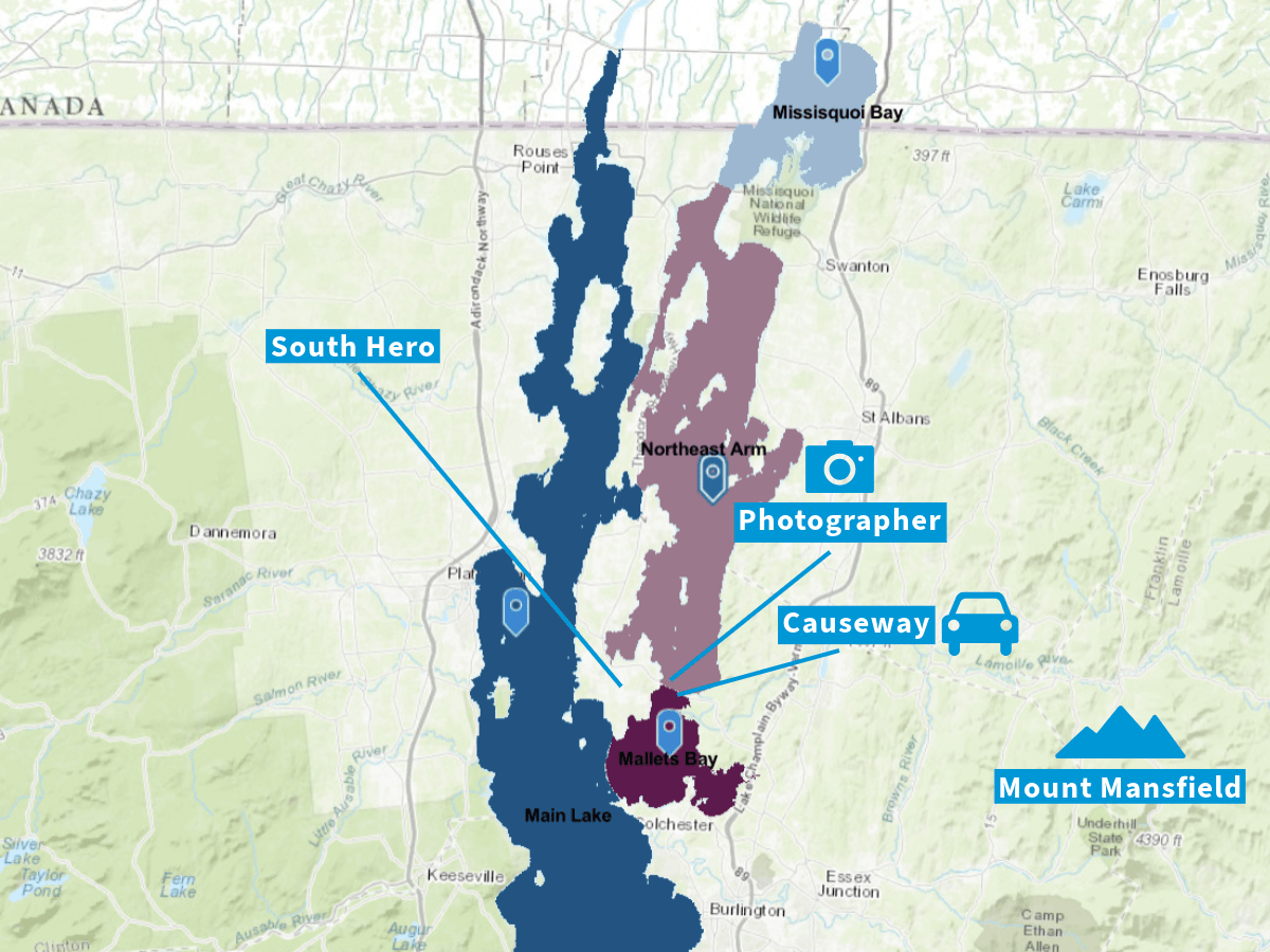
To the south of the causeway, Malletts Bay offers a mix of cold- and cool-water fishing and serves as a recreation hub for sailing and other boating activities.
The Sandbar Causeway itself offers a variety of shallow and mid-depth angling opportunities. The area is both a migration corridor between the Northwest Arm and Malletts Bay, as well as a feeding location for many species of fish. Anglers in this region often find themselves hooking smallmouth and largemouth bass, northern pike, and panfish.
When crossing over the causeway, one can look to the southwest and see a stretch of the Adirondack Mountains of New York rising in the distance. Only certain viewpoints in the Basin offer a glimpse of both the Green Mountains and Adirondacks, whose high points form the eastern and western bounds of our watershed.