First bi-national stream geomorphic assessments for the Rock River
Project Summary
The Lake Champlain watershed crosses international borders, with waters in the U.S. states of New York and Vermont, and the Province of Quebec. This project on the Rock River, a tributary to Lake Champlain’s Missisquoi Bay, marks the first bi-national effort of its kind, laying the groundwork for a more consistent, cross-boundary approach to watershed management. The work provided Phase 1 stream geomorphic assessments (SGAs) for 26.8 miles (43.1 km) and Phase 2 SGAs for 39.8 miles (64.1 km) of the Rock River to identify areas that require restoration work to improve water quality, to mitigate flood and reduce erosion hazards.
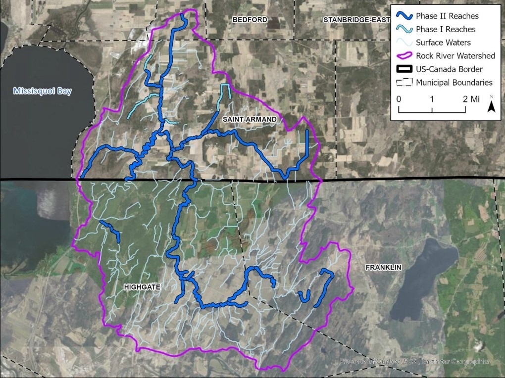
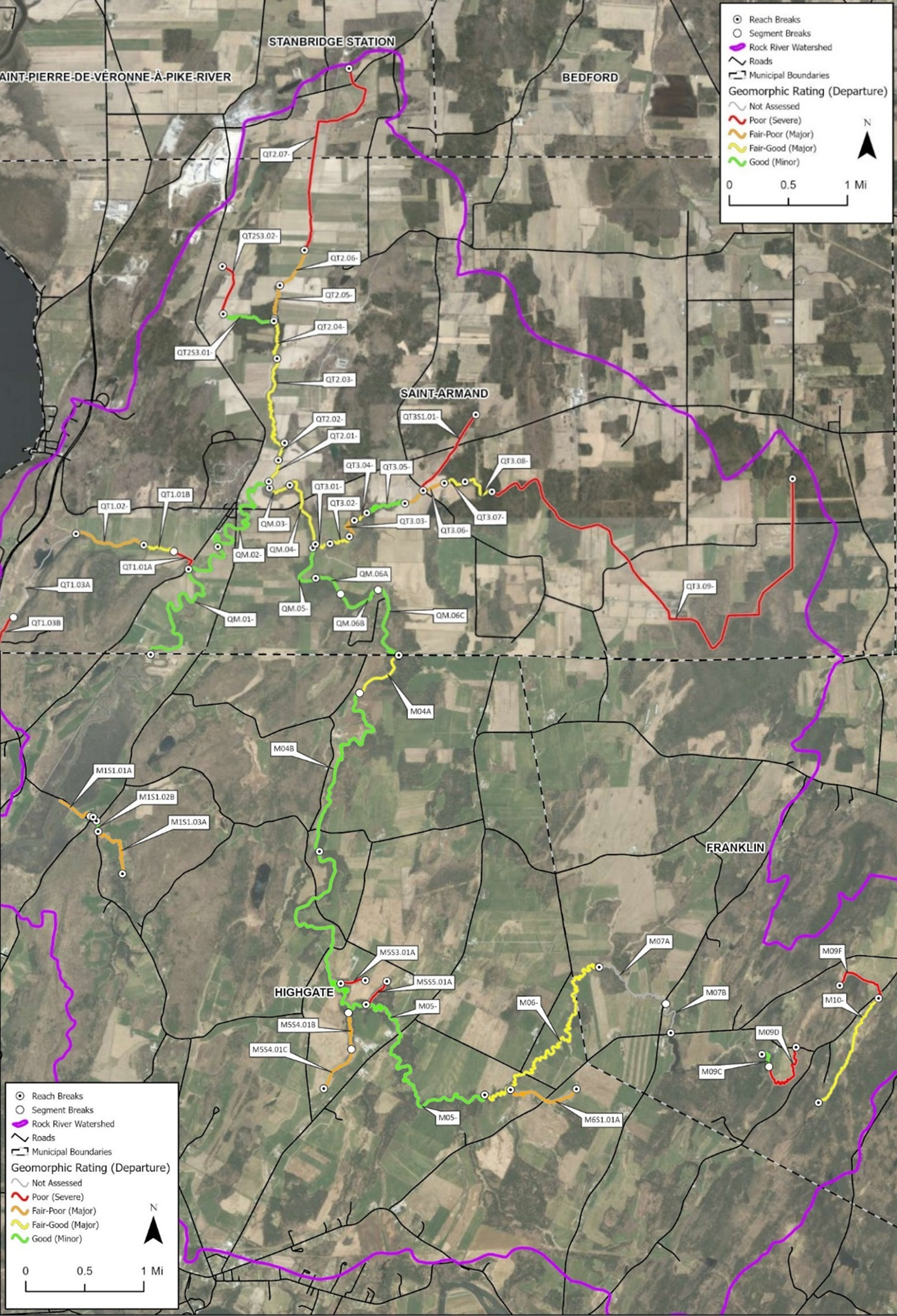
Data collection was conducted in two phases, following Vermont SGA protocols. Phase 1 used GIS, remote sensing, and high-level field assessments to identify significant channel features to develop watershed scale data about the landscape and channel features. Results from Phase 1 identified stream reaches that required more detailed, Phase 2 analyses. Phase 2 data was collected in the field, documenting the physical conditions streams to inform potential river restoration projects, river corridor planning, and flood mitigation efforts. Twenty-eight reaches were recommended for Phase 2 assessments in Quebec, and VTDEC had previously conducted Phase 2 assessments on 19 reaches in the Vermont portion of the watershed, which were reassessed for this project.
Key Results
- The most pervasive impacts identified in the Quebec portion of the Rock River were riparian buffer degradation and channel straightening. These are common impacts from areas with high agricultural and developed land uses.
- Phase 2 assessments revealed that most reaches were stable, with little evidence of active erosion, incision, widening, or planform adjustment. The Rock River mainstem buffers were typically intact, whereas many studied tributary reaches had reduced buffer vegetation and subsequent loss of valuable habitat and filtration capabilities along the river.
- Agricultural ditches and tile drainage systems were extensive within the study area and are important considerations for nutrient and sediment loading.
- 69 projects were recommended along the Rock River, with 15 of those being high priority.
- Recommended work included gully stabilization, stormwater management, floodplain mapping, floodplain reconnection, and river corridor easements to provide water quality benefits.